


Utilities and communications infrastructure companies routinely conduct utility pole audits, where thousands of poles must be measured accurately and safely. Surveys often require 100's of man days in labor. Under mounting pressure to drive efficiency and reduce costs, companies can now turn to ikeGPS mobile GIS systems for help. ikeGPS has developed a unique Pole Audit Solution that enables field crews to dramatically improve productivity while reducing transcription errors and lost time due to safety issues.
ikeGPS Utility Pole Audit Solution
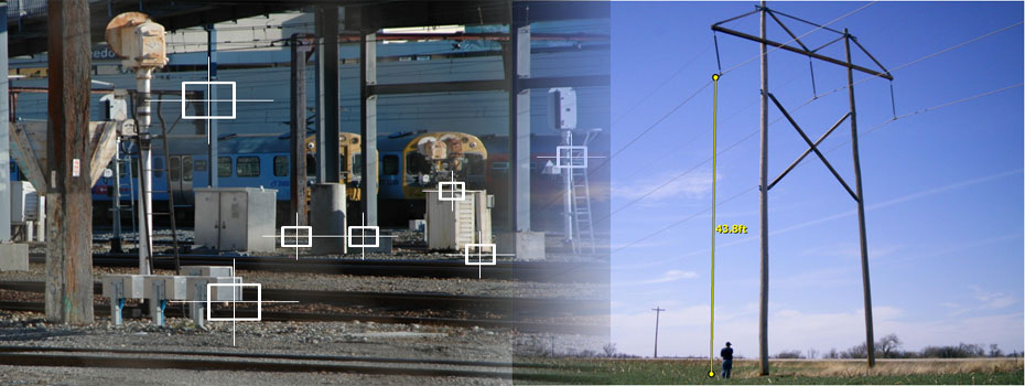
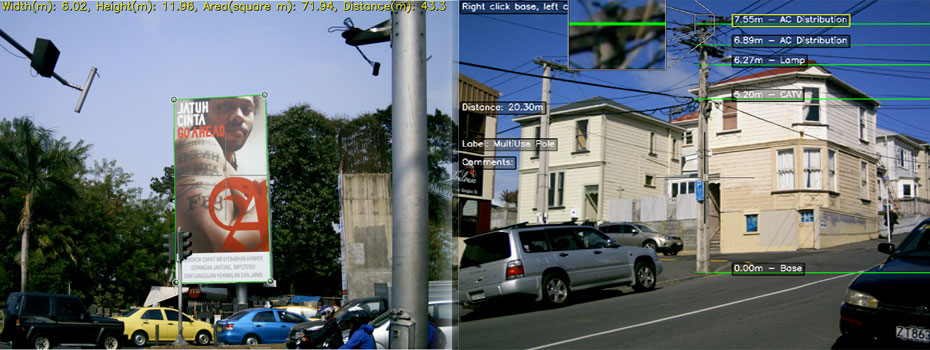
ikeGPS is a unique device for capturing the location of objects for GIS applications and for verifying and annotating the data with GIS referenced images. The ikeGPS Utility Pole Audit Solution takes this capability even further, allowing you to create TrueSize (spatially calibrated) photos and measure the heights, sizes and distances of objects, such as pole attachments and mid-span heights, using onboard software. The ikeGPS Pole Audit Solution includes an easy to use workflow for capturing pole data:
Collecting Data With a single TrueSize photo by ikeGPS, a user collects:
- Precise location of the pole
- Highly accurate heights and descriptions of attachments
- Low cable locations and measurements
- Pole identification
Annotating Measurements
- Use ikeAnnotate to mark the attachments on the pole on the ikeGPS TrueSize photo
- Select a standard attachment description
Generating Reports
- ikeAnnotate exports everything a reviewer needs to make a fast decision.
- ikeAnnotate automatically produces CSV and PDF files with all the data collected
- Visualise the locations and data for every pole using your web browser and ESRI or Google Earth applications
- Auditors and clients can view pole pictures, attachments, and reports using a simple and intuitive interface
The Energy industry uses GIS in a variety of applications, including seismic surveys, pipeline assessments, asset management and many more. ikeGPS makes the collection of GIS data far more safe and efficient than other methods. ikeGPS is unique among mobile GIS devices in several respects:
- Captures the GPS location of distant objects from a safe location
- Integrates high accuracy GPS positioning with a laser rangefinder, 3D compass and digital camera in a single handheld device
- Creates TrueSize™ photos, allowing direct on-screen measurement as well as verification of objects measured
- Measure the Size and Location of Any Distant Object using built-in photogrammetry
- Easily transfer data to ESRI, Google Earth and other GIS platforms
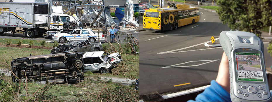
In September 2005, Hurricane Katrina caused wide-scale damage to the Southern United States. According to the US National Hurricane Center, Katrina was the costliest natural disaster, as well as one of the five deadliest hurricanes in the country's history.
Many federal agencies such as Federal Emergency Management Agency (FEMA) and US Military Forces contributed to the response and relief operations. The Army Corps of Engineers (USACE) were also called upon to assist in the subsequent disaster response efforts. USACE was faced with numerous site access problems during the relief efforts. A large number of potential biohazards such as oil spills needed to be located as specific planning or responses were required for these areas. ikeGPS was chosen to help engineers collect GIS data and geotagged images of these biohazards quickly and safely.
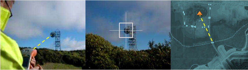
ikeGPS combines a laser rangefinder, GPS, digital camera, compass, and computer in a single handheld device. ikeGPS enables faster, safer, and more efficient field GIS data acquisition through standoff photo positioning: multiple targets up to 1000 meters distant can be positioned from a single location, enabling the operator to remain in a safe and/or concealed location throughout the capture process.
ikeGPS produces a geotagged digital image of each target location, with crosshairs showing precisely which target was captured and other relevant data superimposed right on the image - providing a new degree of verifiability, speed, and safety in GIS data acquisition.
Examples of Disaster Manaegement Use:
- Emergency response to storms and floods
- Damage assessment and recovery plans
- Emergency planning
- Response assessment
State and local governments are looking for ways to better manage assets, drive effiencies and reduce cost. ikeGPS mobile GIS solutions provide unique ways to improve GIS data collection efficiency as well as capture accurate measurements from a remote location.
- Accurately measure the dimensions, area, and volume of remote objects using ikeGPS™ photogrammetry software and applications
- Create TrueSize™ photos, allowing direct on-screen measurement as well as verification and data transfer to ESRI, Google Earth and other GIS platforms
- The user simply needs to point, aim, and capture to instantly acquire accurate target location data and geo-referenced images
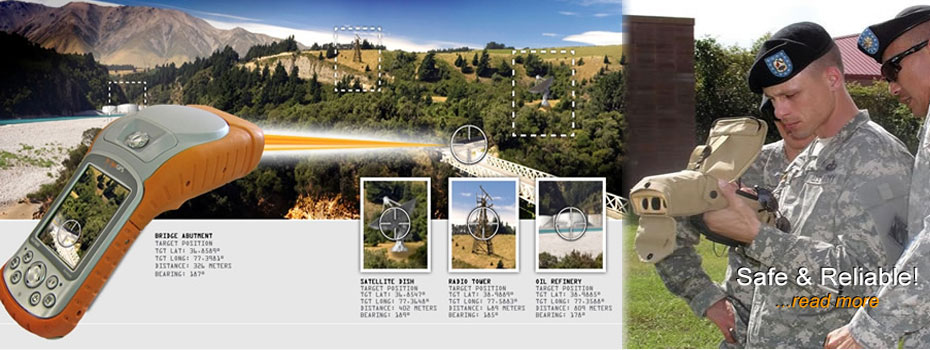
- ikeGPS enables Military personnel to capture GIS data in situations that would be impossible with traditional GIS systems. Targets in hazardous or unfriendly locations can easily and rapidly be positioned from a safe distance with "point and shoot" capability, and operations benefit from having a verifiable, georeferenced digital image of each target.
- ikeGPS combines a laser rangefinder, GPS, digital camera, compass, and computer in a single handheld device. ikeGPS enables faster, safer, and more efficient field GIS data acquisition through standoff photo positioning: multiple targets up to 1000 meters distant can be positioned from a single location, enabling the operator to remain in a safe and/or concealed location throughout the capture process.
- ikeGPS produces a geotagged digital image of each target location, with crosshairs showing precisely which target was captured and other relevant data superimposed right on the image - providing a new degree of verifiability, speed, and safety in GIS data acquisition.


